UMAP UAV Intelligent Aerial Survey System
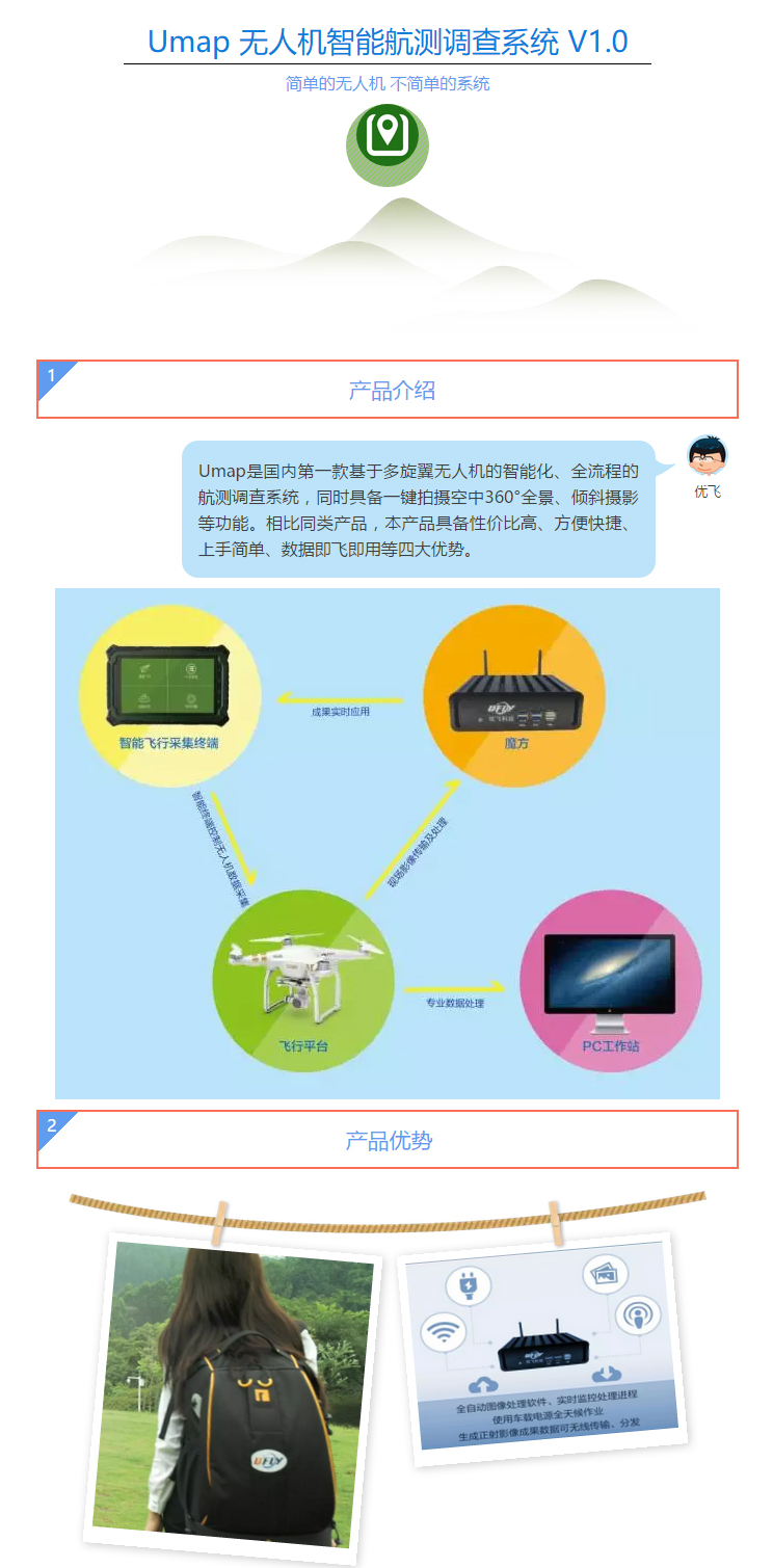
UMAP is the first intelligent and all-process aerial survey system based on multi-rotor UAV in China. It also has functions such as one-click shooting of 360 degree panorama in the air, tilt photography and so on. Compared with similar products, this product has four advantages, such as cost effective, convenient and efficient, easy to use, and data is available for immediate use.
√ Flight control: using DJI multi-rotor flight platform, mature technology, reliable, portable, cost-effective, through the mobile terminal to achieve intelligent and safe control of the UAV.
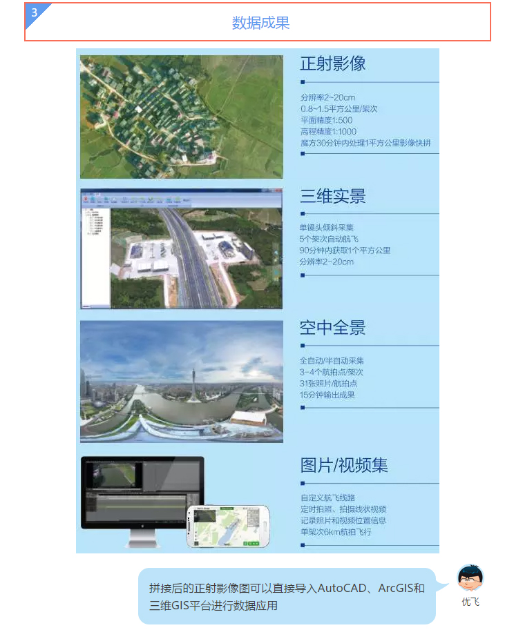
√ Data acquisition: support three modes of automatic shooting: orthophoto, tilt photography and 360 degree air panorama . It has powerful functions to achieve convenient data acquisition, each sortie flies one square km , and achieves 10~15 square km per day
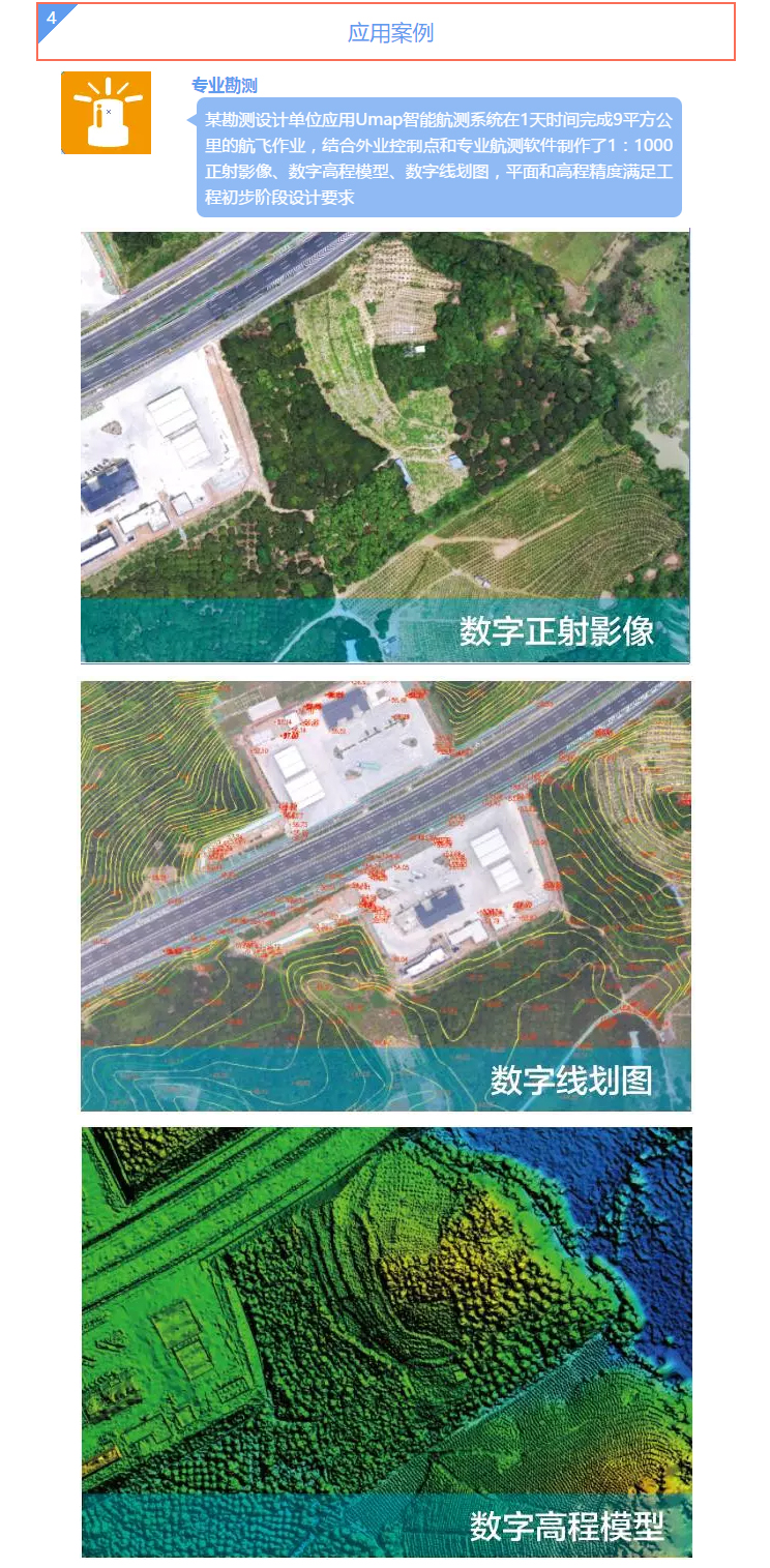
√ Data processing: the "Rubik's Cube" can be used for fast and automatic data processing on the spot, without manual intervention, and it can be flown out of the box within 30 minutes. Professional applications can also be met by PC data processing workstations.


